By clicking the ATLAS button, you’ll display a new window, depending you are ONLINE or OFFLINE.

OFFLINE mode (2D) #
Download Tiles #
First download tiles to consult map offline. Click on MAPS to do that. See WORLD ATLAS
Consult maps in flight #
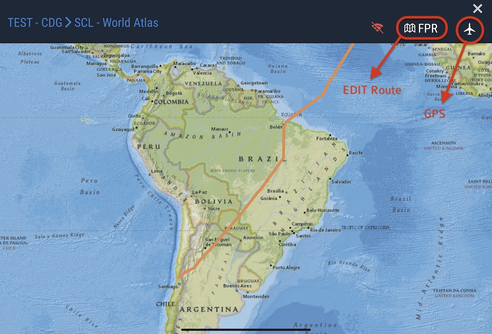
You can display a world ATLAS from zoom 4-8, and display your FPR. Pan and Pinch to zoom.
Flight Plan Route #
FPR can be inserted within your flight by taping FPR button. If no FPR, great circle is displayed.
GPS #
map can be centered on your GPS position. In flight, at high speed, your device may not acquire sufficient accuracy. Using a GLO GPS bluetooth will make it work perfectly.
SPIDER MODE #
(AF ONLY) : when GPS is activated, you can display the shortest airport around you with 3 colors : EMER, ADEQUATE, MEDICAL, according to the aircraft type used.
ONLINE mode (3D) #
your device will detect automatically if you are online. This is used specifically on ground to replay your flight for example.
2 maps are available : atlas (same as 2D Atlas) or satellite. Just click on map icon on the top right.


The animation is automatically playing, along your flight route, at 30000 ft alt. You can leave the animation at all time, by panning the view.
Click on an arrow to jump forward/back to next/previous waypoint. Displayed ETAs are computed roughly by distance and real blocktimes.
Sunlight is real according to your blocktimes.
Relief 3D is available to ensure a fair immersion. Here is the Aconcagua, in Andes mountain, upon arrival in Santiago del Chile, at sunrise.
